ABOUT THE PROJECT
Borders as a cultural-historical phenomenon: Specification, analysis, comparison, and interpretation is a project of applied research and development of national and cultural identity (NAKI III) of the Ministry of Culture, identification code of the project DH23P03OVV030, for 2023‒2027. It builds on the cooperation of the Institute of History of the Czech Academy of Sciences and the Department of Geomatics of the Czech Technical University in the field of atlas historical cartography, implemented during the creation of the Academic Atlas of Czech History (2014, 2016; bestowed, among other things, with the Magnesia Litera, awarded in 2015), within the Czech Historical Atlas Český historický atlas project (NAKI II of the Ministry of Culture, identification code DG16P02H010, for 2016‒2020), the Historic Towns Atlas of the Czech Republic and other historical cartographic works. The project is related to R&D&I (Research, Development, and Innovation) Priorities 1. National and cultural identity in archaeological, historical, and socio-cultural continuity or discontinuity and their reflection on the historical territory of the Czech state, 6. National and cultural identity in relation to the external European cultural environment and 22. Historical, cultural, economic, and social development of the historical territory of the Czech state.
Borders are a term that expresses the society’s activities since its beginnings, connected with several forms of boundaries and landmarks. It is a spatial phenomenon, influenced by many aspects, mainly territorial-administrative, power and ideological, ethnic, religious, cultural or mental. New borders are constantly created, changing, disappearing, and intermingling in layers. They are real and imagined, recorded, often inaccurately in the field, in documents and in the human mind. The diversity and variety of borders creates a complex set of facts, problems, and questions. Understanding the topic of borders in the sense of their identification, i.e., their temporal, horizontal and vertical layers along with a clear orientation in space, is quite difficult for the general public and many experts, domestic and foreign.
The main goal of the presented project is to create a concept of basic groups of borders and border changes in the Czech lands with a link to the Central European area from the Middle Ages to the end of the 20th century; to treat the basic files of individual types of borders; analyse, compare and interpret the acquired data; to make the results of the research available to the lay and professional public, including the educational sphere, and thus provide as far as possible a comprehensive picture of the types of borders and their changes.
The proposed project will be solved within five thematic modules:
I. Borders, their typology, symbolism, and ways of expression in the preserved sources;
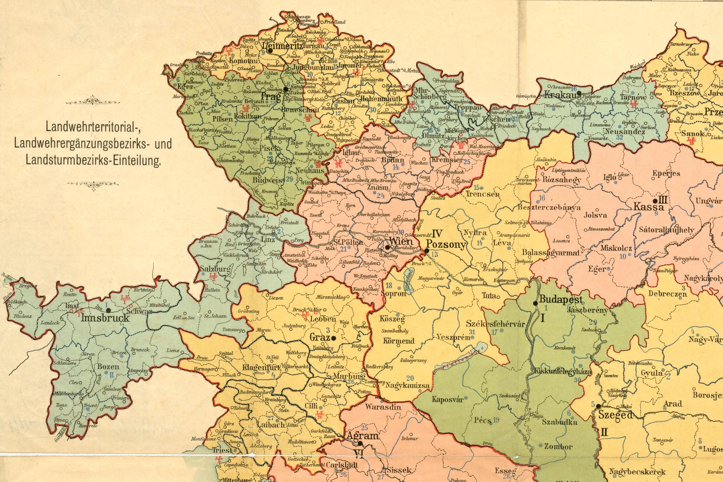
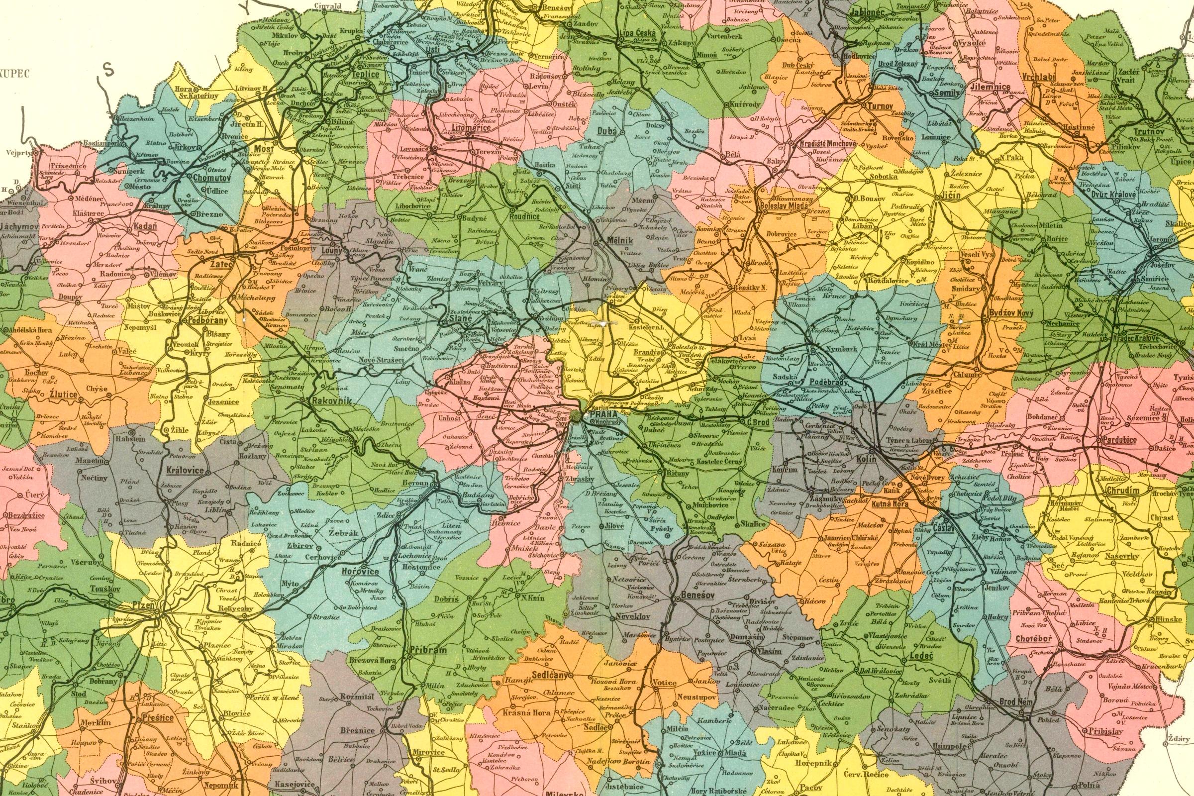
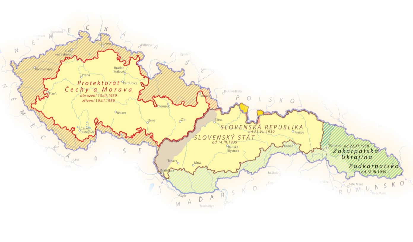
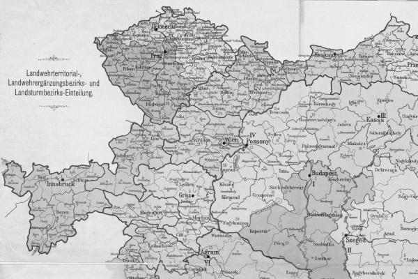
II. Borders as a reflection of territorial administration, power ambitions and conflicts;
III. Borders as a reflection of ethnic, linguistic, and cultural-anthropological specificities;
IV. Borders as a reflection of historical specifics and anomalies;
V. Borders as a reflection of the diversity of opinions in contemporary society.
OUTPUTS
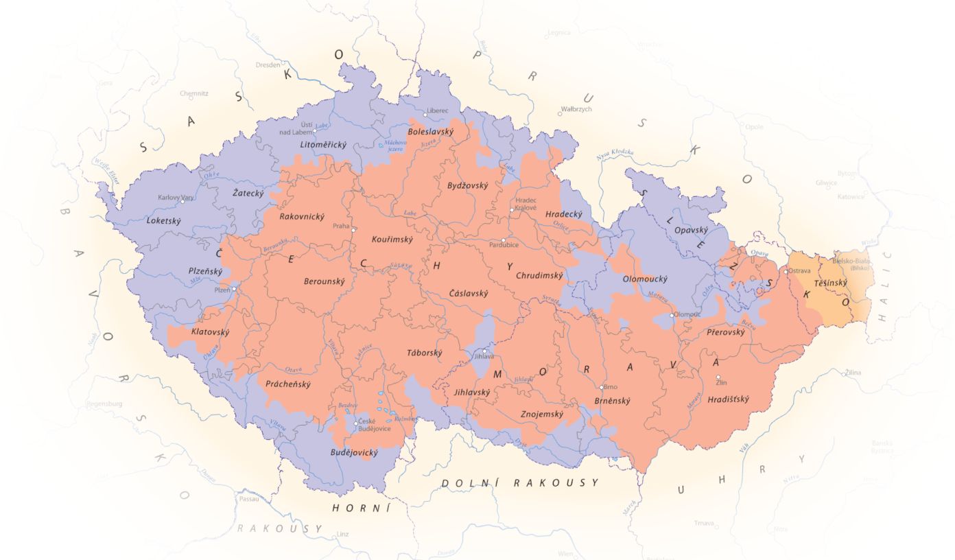
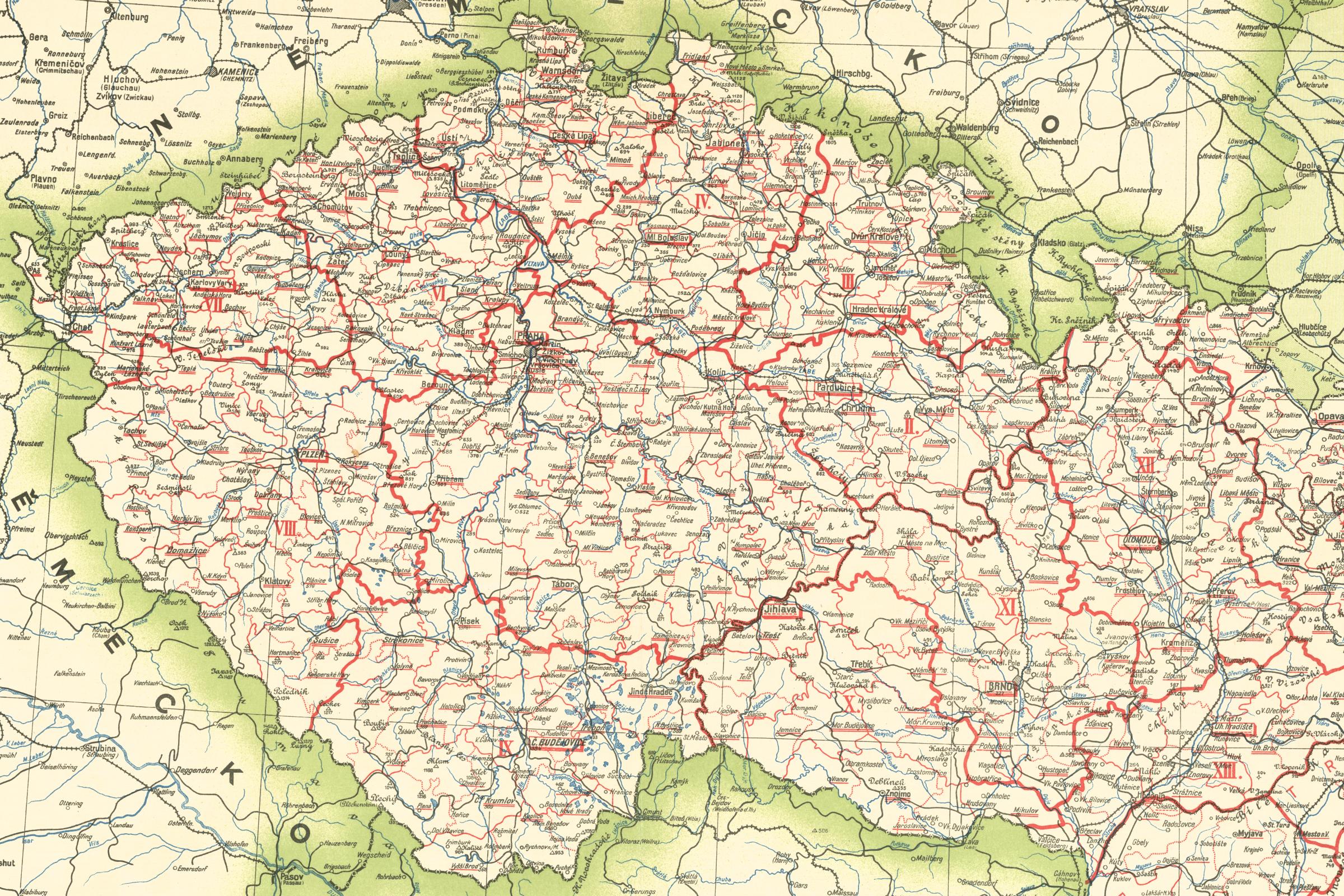
Borders as a reflection of territorial administration, power ambitions and conflicts
An interactive map consisting of a set of borders depicting national, linguistic, and anthropological topics, especially from the end of the 19th century. The influence of ideological and power aspects will be evident. It will also contain the borders of language islands, ethnographic and dialect areas, anthropological specifics, based on the boundaries of historical and contemporary territorial administration. In preparation, Completion: 2026.
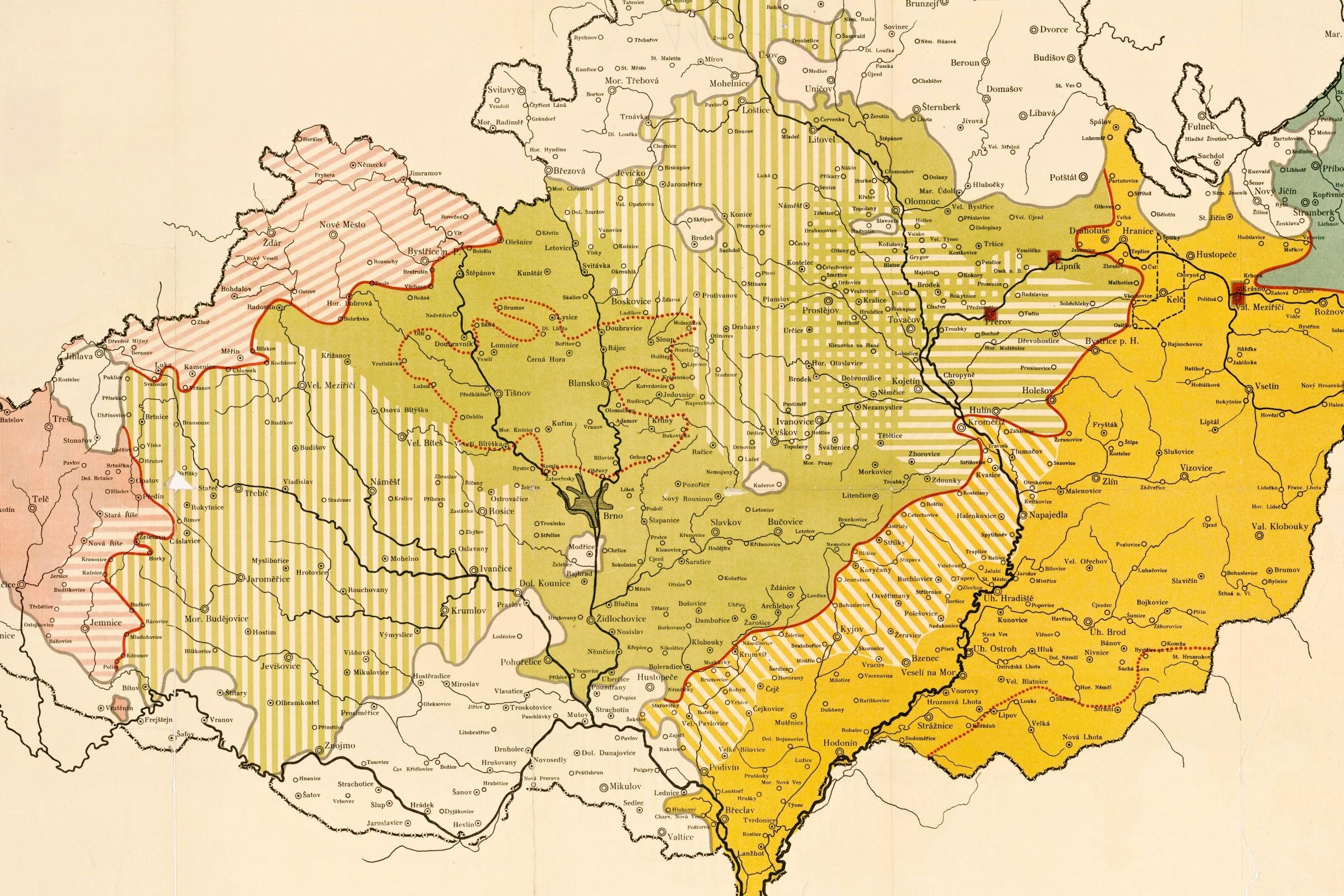
Borders as a reflection of ethnic, linguistic, and cultural-anthropological specificities
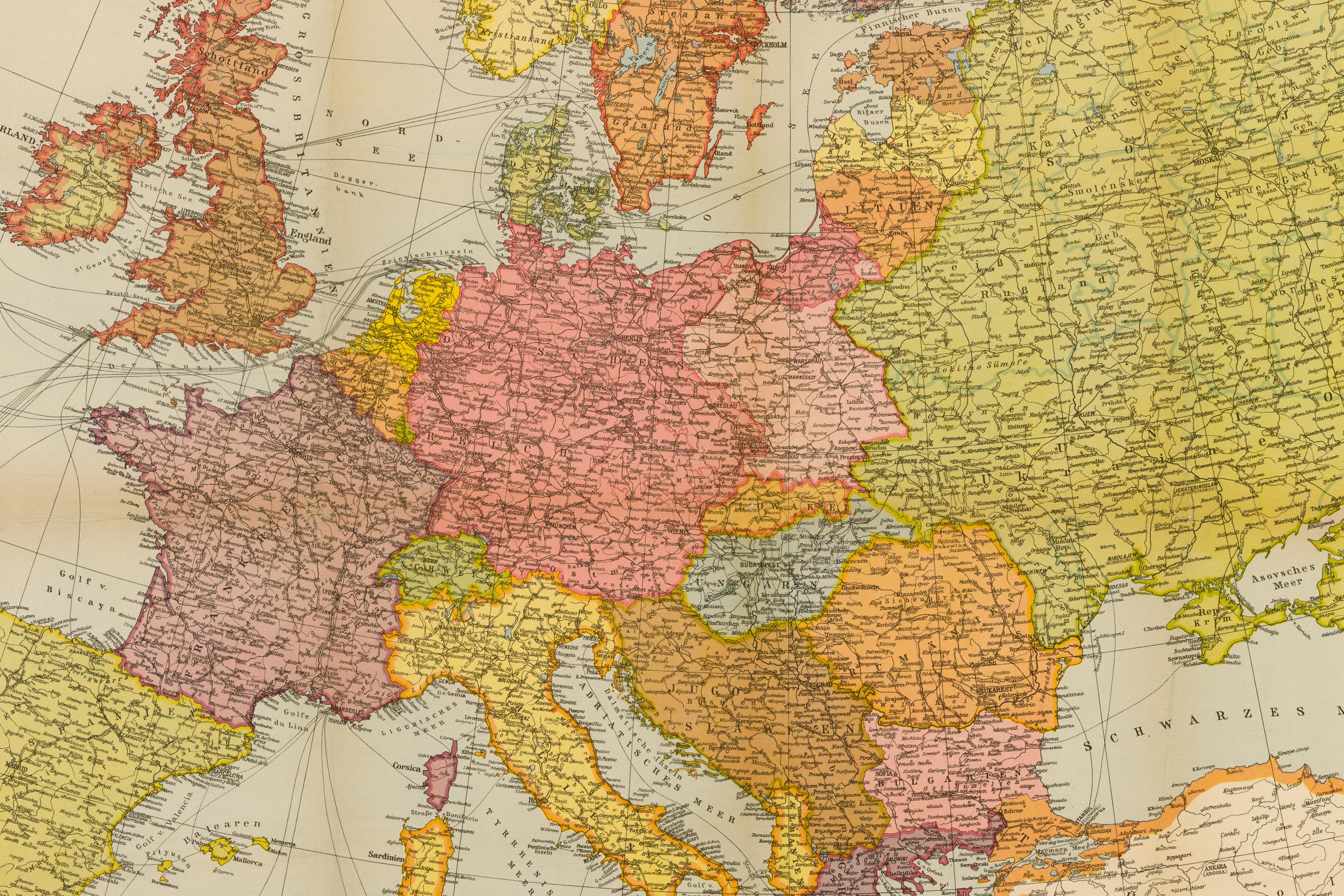
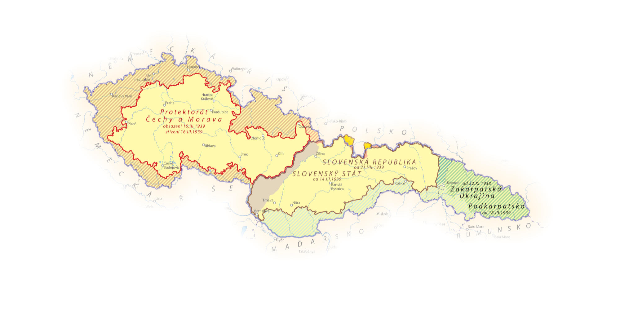
An interactive map consisting of a set of borders on the topic of defining the borders of various power units, changing in time and space from the Middle Ages to the end of the 20th century, including a synoptic, comparative grasp of the geopolitical border changes (palimpsest of borders - their layering and rewriting), namely based on boundaries of historical and contemporary territorial administration. In preparation, Completion: 2027.

Database
Historical borders in the Central European space. A specialized public database containing spatial and descriptive data of historical borders in the Central European area. In preparation, Completion: 2027.
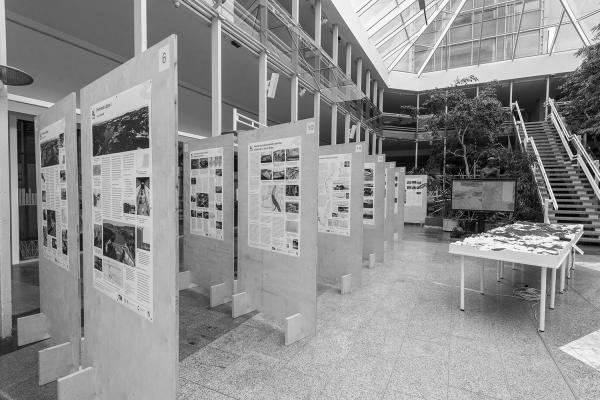
Exhibition
Along with a critical catalogue, the exhibition introduces visitors to the issue of historical borders and their types, captured in selected, specific examples, namely in the form of two- and three-dimensional exhibits. Deadline: 2027.

Workshop
A seminar for the professional public, focusing on the issue of historical borders in the Central European area. Deadline: 2026.
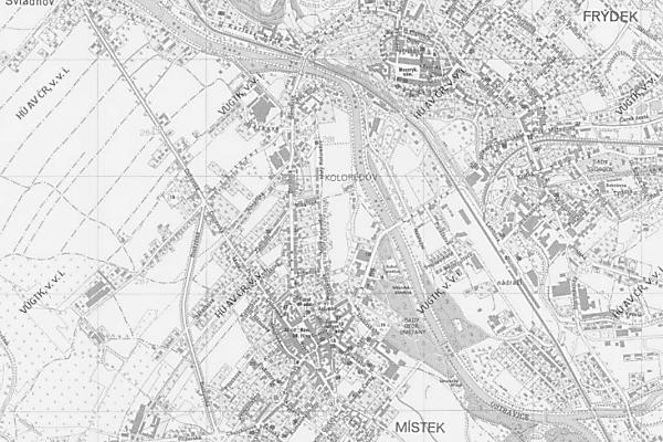
Frýdek-Místek: Town on the Borders
The publication result will present the town of Frýdek-Místek as an example of a settlement on the land borders of Moravia and Silesia. Using map reconstructions, old maps, illustrations and in the text, a picture of the development of the town will be given in connection with the development of the mentioned land borders. Publication: 2026.
Borders as a cultural-historical phenomenon
The publication will focus on the theoretical-methodological understanding and interpretation of the phenomenon of borders and boundaries in its thematic breadth and historical continuity in terms of time and space. It will present the typology of borders, provide their characteristics and present selected case studies and examples of unique preserved sources, mainly cartographic ones. Publication: 2027.

Other publication outputs
Articles, specialised texts, etc., from 2025.